POINTCLOUDCOLORMAP command
Colorizes the point cloud.

Icon: 
Description
Colorizes the point cloud based on a range of colors.
Options within the command
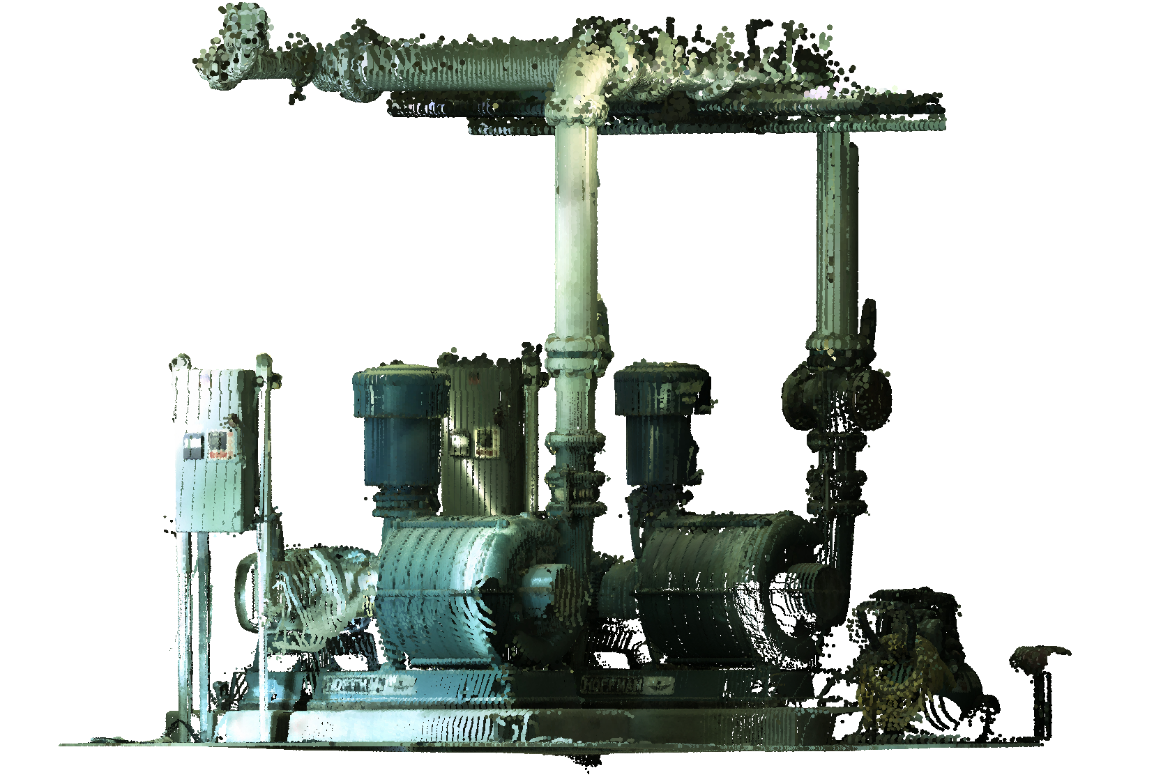
- Scan
- Assigns color based on the color data collected by the scan.
-
- Elevation
- Assigns color based on the elevation of the points using a specified color map.
-
- Spectrum
- Assigns a range of colors based across the color spectrum.
- Earth
- Assigns a range of colors from light brown to dark brown.
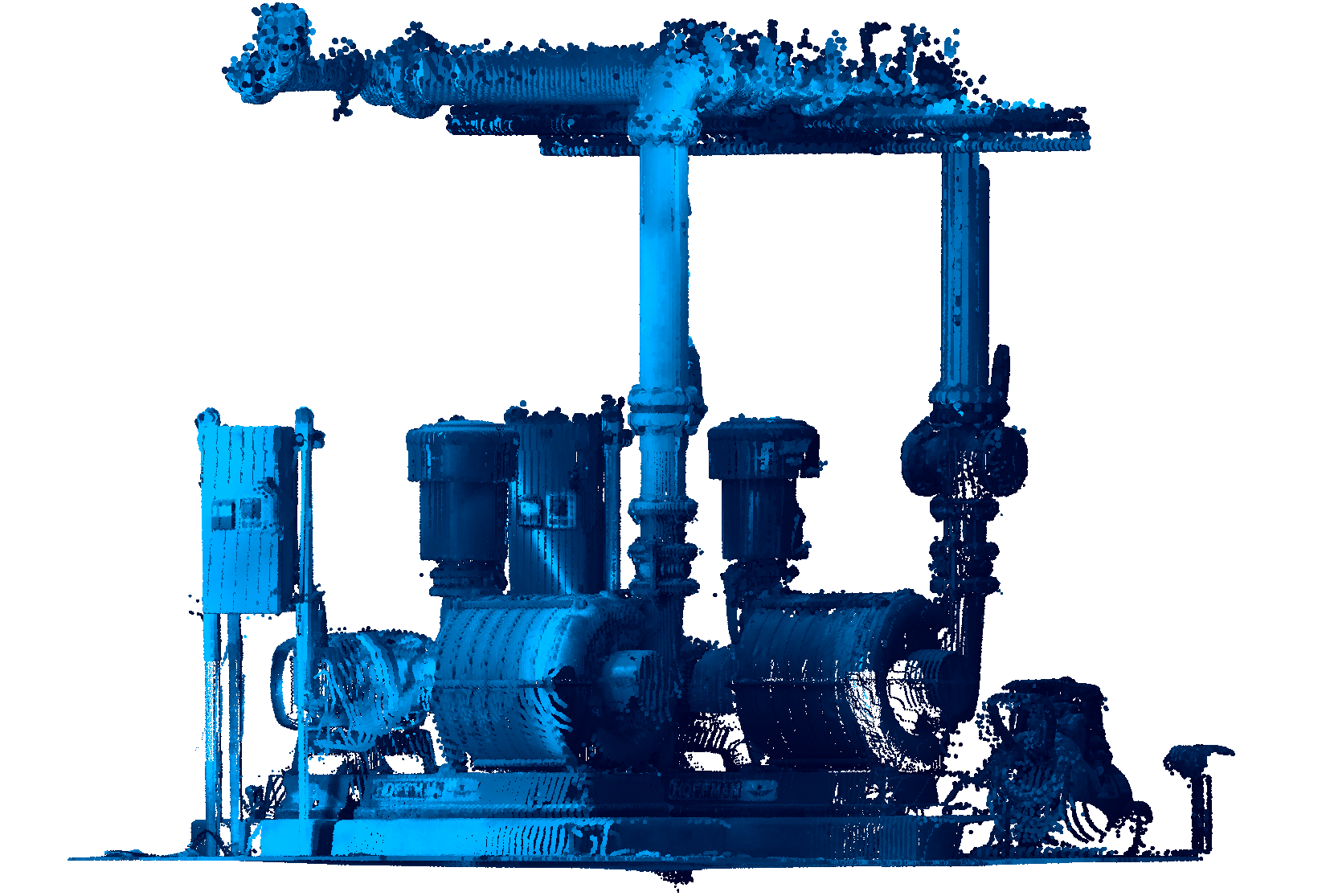
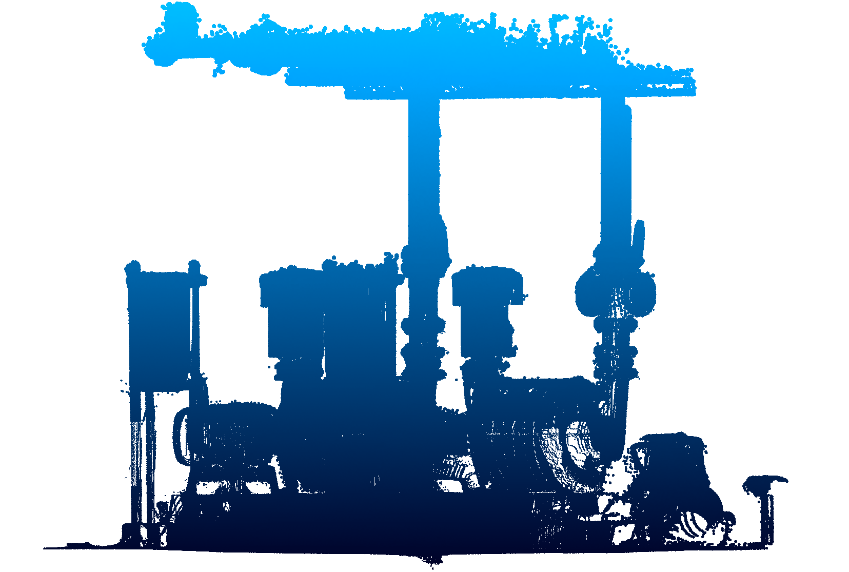
- Hydro
- Assigns a range of colors from light blue to dark blue.
- grAy
- Assigns a range of colors from light gray to dark gray.
- Reds
- Assigns a range of colors from light red to dark red.
- Greens
- Assigns a range of colors from light green to dark green.
- Blues
- Assigns a range of colors from light blue to dark blue.
- Intensity
- Assigns colors according to their intensity value based on the specified color map.
-